
| Responder Overview > Responder Toolbar in ArcMap > Show Multiple Responder Features |
Version: 10.1 |
Available in ArcMap.
The Show Multiple Responder Features tool allows users to select an area on the map and locate incidents and/or calls associated with all selectable features (i.e., incidents, electric features, location features, hazards, and load points) within the polygon. If devices have been selected in Responder Explorer before using this tool, the original selection set is cleared before selecting a new one.
Note: While drawing the polygon, it is possible to click outside of the map display (e.g., on the Table of Contents). This may result in a vertex on a portion of the map that is not visible.
|
Responder Explorer must be open to display incident data.
|
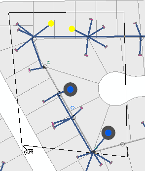
Selecting multiple features. Calls shown in yellow and incidents in blue/gray.
All incidents associated with the selectable features (i.e., incidents, electric features, location features, hazards, and load points) located within the polygon are highlighted in Responder Explorer. Calls are highlighted on the calls tab and incident devices on the Incidents tab. Responder will not change the tab display. For example, if you have the Calls tab displayed and select incidents with the Show Multiple Responder Features tool, you will need to click the Incidents tab to see the incidents highlighted in Responder Explorer.
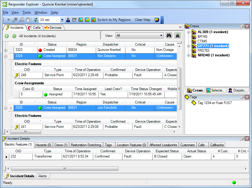
Selected incidents on Incidents tab
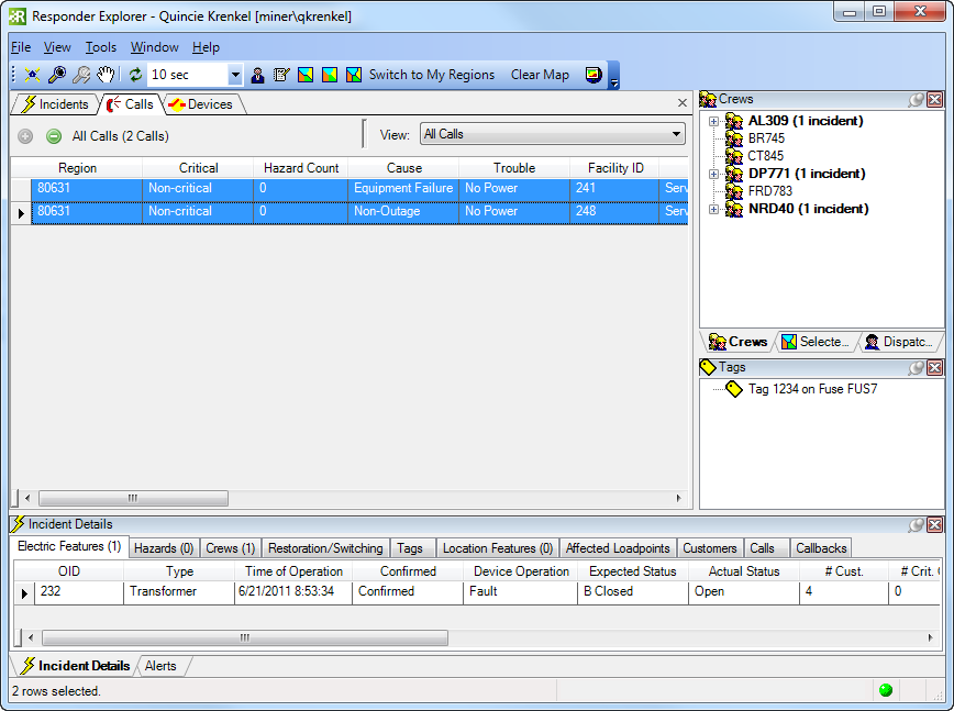
Selected calls on Calls tab
The polygon may not intersect itself. Below is an example of an invalid polygon:
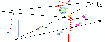
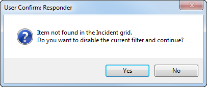
If the incident is not shown in Responder Explorer because the filter applied removes it from the list, you will see the message below. For example, the selected device has an incident with a crew assigned, but the Responder Explorer filter is set to Unassigned. The selected incident has been filtered out of the Responder Explorer display. Select Yes to return the filter to Show All. Select No, and the selected incident will not be displayed in Responder Explorer.
