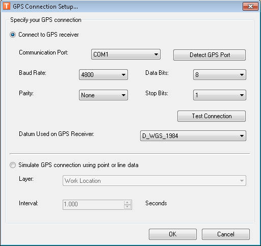
Before using GPS Support for the first time, you must set up the GPS connection based on the GPS device you'll be using. Once you have set up the connection information, you will not need to modify it unless your GPS device changes.
Connect to GPS receiver: Select this option to connect to a GPS receiver. Determine the settings based on your GPS receiver. The Datum Used on GPS Receiver field now offers an expanded list of options.
GPS Support provides two buttons that let you test your connection information. The Detect GPS Port button looks for a GPS receiver at each available Communication Port. If it finds one, it places the name of that Port in the field (e.g., COM3). The Test Connection button attempts to receive data from a GPS receiver based on the settings. A message will indicate the availability and strength of a connection.
Simulate GPS connection: You may use this setup option to simulate how the tool works with a GPS device in the field. This option does NOT require that a GPS device be connected. This option is for simulation only and won't be used in production.

