Responder Mobile Configuration Guide
Create Map Service
Version: 10.2.1c and 10.2.1c SP3 |
| Responder Mobile > Create Map Service |
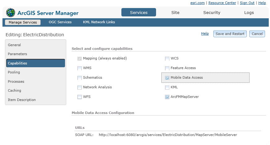
Now that you have created your mobile map, you can set up the map service that allows you to view features, and assign incidents and hazards on those features. Use ArcGIS Server Manager to make layers available for selection in the field. Follow the steps below to set up your electric layers for use in the field. Refer to Esri documentation for more help on ArcGIS Server Manager.
 |
To use the map service, you need either ArcFM Server or the 64-bit Object Reader installed. |
These steps use the same *.mxd file created with the Create Mobile Map set of steps.
 |
The more you can optimize the map service data, the better the performance in the field. Esri offers tools and documentation for optimizing a map service. |
|
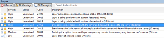
If one or more of your warnings state "Data source is not registered with the server and data will be copied the server" then you will want to register your data source. Otherwise, all the data will be hard copied to your server and can consume a lot of memory. To register your data source:
|
|
If you have trouble creating the service with the Mobile Data Access capability, you may not have set a custom extent when creating your *.mxd. See step 3 in the Create Mobile Map topic to set the extent. |