ArcFM XML Export allows you to export specific properties on object, feature, or relationship classes from your geodatabase into an XML file. You may export all of the features in the geodatabase, all of the features in a dataset, or an individual feature.
- Select the geodatabase, dataset, or feature class to be exported. If you elect to export a geodatabase, only one may be exported to an XML file. Multiple geodatabases may not be exported into the same XML file.
- Click the ArcFM XML Export button
 on the ArcFM Solution toolbar. You may click the Esc key to dismiss the XML Export dialog.

- Select the type of ArcFM Solution information to be exported. You may select any or all of these options before exporting data. Some are available only at the geodatabase level.
- ArcFM Model Name Information: Use this option to include the model names in your export
- ArcFM Properties: Use this option to include the ArcFM Properties Manager settings (e.g., autoupdater assignments).
- ArcFM Relationship Class Information: Use this option to include autoupdaters assigned to relationship classes.
- ArcFM Snapping Information: Use this option to include the snapping settings.
- Custom Object Types: Use this option to include custom object class and extension information. The following data is included in the export: object class name, object class ID name, object class ID, object class extension name, and object class extension.
- Designer Database Properties: Use this option to include extended data definition table settings for non-GIS CUs. This is only available at the geodatabase level (Designer only).
- Domains: Use this option to include domains. Available only at the geodatabase level.
- Optimization System Layers: Use this option to export Optimization layers. These are the layers configured to display symbology for Design Optimization.
- Browse to a location and enter a file name for the exported information. The default file type is *.xml. Files exported as HTML may not be imported back into the geodatabase.
- Check Apply Style Sheet option if you want to tailor the style of XML files. Provide a path to an xsl file (several are provided in the ArcFM Solution installation folder at ArcFM Solution | Bin | Style Sheets. When using a style sheet, you may export information to HTML and XML formats. A list of style sheets and their uses is available in the Appendix.
- Click Export. A progress bar displays to show export status. You may click Esc to cancel.
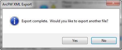
- An "Export Complete" message indicates the XML file has been successfully created at the location selected in step 4.
 |
Currently, values in binary large object (BLOB) fields are not exported to XML. In the Minerville sample data, only Conduit System feature class uses a BLOB field and it stores conduit configuration information.
|


