
Version: 10.2.1c and 10.2.1c SP3 |
| ArcFM Desktop > ArcFM > Configure Map Production |
Map Production requires minimal configuration in ArcCatalog. All Map Production users must have read permissions on the MM_SYSTEM_PACKAGES table to view system map books. Users must have write permissions on this table to create system map books. Read and write permissions on the MM_PACKAGES table are required to create user map books. Users who wish to create Design map books must have write permissions on the MM_HIDDEN_PACKAGES table (Designer only).
If users experience problems opening map books, you may need to increase the allowable character length for the NAME field in the MM_PACKAGES, MM_SYSTEM_PACKAGES, or MM_HIDDEN_PACKAGES table. The Name field by default is set to 33 characters long. You may modify the length of this field to any value. However, Schneider Electric recommends it be at least 33 characters long. If a map book name exceeds the set length of the Name field, the map book may not be opened. Adjusting the length of the Name field solves this issue. This is most common with design map books stored in the MM_HIDDEN_PACKAGES table.
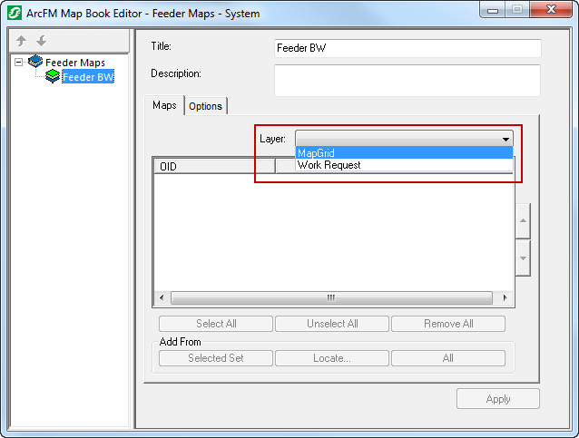
If you wish to add a feature class to the Layer dropdown menu, assign the model name MAPGRID to that feature class.

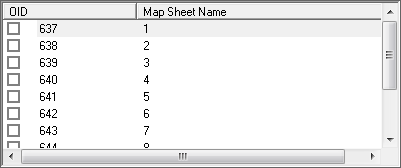
The second field in the grid on the Maps tab displays the Primary Display Field value. (Map Sheet Name in the example below). To change the attribute value displayed here, right click the feature class and select ArcFM Properties Manager. Then click the Field Display tab and change the value of the Primary Display Field.

ArcFM provides a list of scales in the Maintain Scale dropdown menu. If you wish, you may change these values by creating a domain called ArcFM Map Scale with a field type of Text. Indicate the default item by putting "Default" in the description field for that item.

Map Production will rotate a map sheet to match the orientation of your page template or document. But this will ONLY occur if the map sheet was created using the Map Grid Generator.
Invalid Layers
You may assign the MP_INVALIDATELAYER model name to indicate a feature layer as invalid. This means that when it is the only layer in a map sheet, that map sheet won't print or export. A layer with this model name will print when valid layers (those without the MP_INVALIDATELAYER model name) are present in a map sheet.
For example, you may assign the MP_INVALIDATELAYER model name to the Buildings layer. Any map sheets that contain only buildings will not be printed. The building features will plot on map sheets that contain buildings as well as valid features.
Existing map sets created in a previous version of ArcFM or Designer (pre 8.3) need to be updated to work with 8.3. The Upgrade ArcFM Solution Database tool in ArcCatalog upgrades existing map sets to be compatible with ArcFM Solution 8.3.