
| ArcFM Desktop Overview > ArcFM > Routing and Direction Tools > Direction Search |
Use the Direction Search tool to create driving directions between two points. The Direction Search tool allows you to populate the address fields by entering them manually, clicking points on the map, or using GPS points gathered using a GPS feed.
The Direction Search tool may be used on StreetMap data or with a Network Dataset in a geodatabase. Steps for creating a Network Dataset in your geodatabase using ArcCatalog are available in the ArcGIS for Desktop Help. If you are using a Network Dataset, be sure to add the feature class containing the address information (e.g., StreetCenterline or Street) and the Network Dataset layers (along with any classes that participate in the network) to the map document.
Licensing: Using a Network Dataset requires a valid Network Analyst license from Esri. Select this license in the ArcGIS for Desktop Administrator. Ensure that the ArcGIS license you have checked out has a Network Analyst extension available.
 tool. If this button is not available on the ArcFM Solution toolbar, add it.
 |
If you have selected a Locator that does not support reverse geocoding, the Direction Search button will remain disabled. |
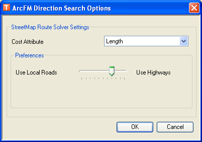
 Figure 1, Direction Search Options for StreetMap data |
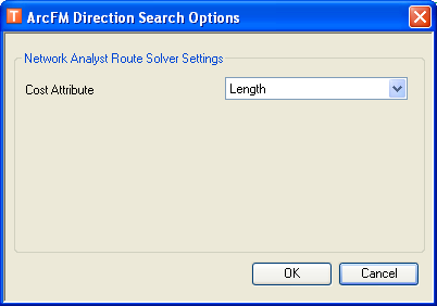
 Figure 2, Direction Search Options for Network Dataset data |
StreetMap Route Solver Settings: These settings include two cost estimate values: Length and Time. Length finds the shortest distance between two points. Time finds the quickest route between two points. The Preferences field allows you to determine the type of route: using mostly local roads or mostly highways. Move the slide cursor to indicate which you prefer and to what degree.
Network Analyst Route Solver Settings: These settings include only the Length cost estimate. This value finds the shortest distance between two points.
 Select Location: Use this button to click a location on the map. Select the button in the Start Address field to determine a beginning point, and select the button in the End Address field to specify an end point.
 GPS: When you click this button, the fields are populated with the current GPS coordinates. An open GPS connection must exist in order for this button to be enabled.
 button.
Figure 3, Direction Search using StreetMap data
Figure 4, Driving directions and map displayed in separate web browser